ShopDreamUp AI ArtDreamUp

Deviation Actions


![Bourmout [frontpage]](https://images-wixmp-ed30a86b8c4ca887773594c2.wixmp.com/f/b4b868d6-b2d6-4489-9781-a2612af4fb5c/d7yjqbr-2f87e91c-c673-4141-be29-1bff4ccb51db.jpg/v1/crop/w_184,h_184,x_0,y_21,scl_0.12266666666667,q_70,strp/bourmout__frontpage__by_sirinkman_d7yjqbr-92s-2x.jpg?token=eyJ0eXAiOiJKV1QiLCJhbGciOiJIUzI1NiJ9.eyJzdWIiOiJ1cm46YXBwOjdlMGQxODg5ODIyNjQzNzNhNWYwZDQxNWVhMGQyNmUwIiwiaXNzIjoidXJuOmFwcDo3ZTBkMTg4OTgyMjY0MzczYTVmMGQ0MTVlYTBkMjZlMCIsIm9iaiI6W1t7ImhlaWdodCI6Ijw9MjE5NyIsInBhdGgiOiJcL2ZcL2I0Yjg2OGQ2LWIyZDYtNDQ4OS05NzgxLWEyNjEyYWY0ZmI1Y1wvZDd5anFici0yZjg3ZTkxYy1jNjczLTQxNDEtYmUyOS0xYmZmNGNjYjUxZGIuanBnIiwid2lkdGgiOiI8PTE1MDAifV1dLCJhdWQiOlsidXJuOnNlcnZpY2U6aW1hZ2Uub3BlcmF0aW9ucyJdfQ.rUt9aG2smSnX1hJxnFKLBZT4lp0V3pzY9wOYIY5Nlk4)
![Bourmout [frontpage]](https://images-wixmp-ed30a86b8c4ca887773594c2.wixmp.com/f/b4b868d6-b2d6-4489-9781-a2612af4fb5c/d7yjqbr-2f87e91c-c673-4141-be29-1bff4ccb51db.jpg/v1/crop/w_92,h_92,x_0,y_11,scl_0.061333333333333,q_70,strp/bourmout__frontpage__by_sirinkman_d7yjqbr-92s.jpg?token=eyJ0eXAiOiJKV1QiLCJhbGciOiJIUzI1NiJ9.eyJzdWIiOiJ1cm46YXBwOjdlMGQxODg5ODIyNjQzNzNhNWYwZDQxNWVhMGQyNmUwIiwiaXNzIjoidXJuOmFwcDo3ZTBkMTg4OTgyMjY0MzczYTVmMGQ0MTVlYTBkMjZlMCIsIm9iaiI6W1t7ImhlaWdodCI6Ijw9MjE5NyIsInBhdGgiOiJcL2ZcL2I0Yjg2OGQ2LWIyZDYtNDQ4OS05NzgxLWEyNjEyYWY0ZmI1Y1wvZDd5anFici0yZjg3ZTkxYy1jNjczLTQxNDEtYmUyOS0xYmZmNGNjYjUxZGIuanBnIiwid2lkdGgiOiI8PTE1MDAifV1dLCJhdWQiOlsidXJuOnNlcnZpY2U6aW1hZ2Uub3BlcmF0aW9ucyJdfQ.rUt9aG2smSnX1hJxnFKLBZT4lp0V3pzY9wOYIY5Nlk4)


Description
=============================================
Pealkiri: Vana-Kastre piiskopilinnus
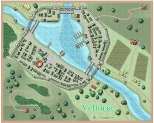
Title: Vana-Kastre bishop's castle
=============================================
A fictional reconstruction of the medieval Vana-Kastre bishop's castle. Compared to my previous "reconstructions", there is even less certainty about the historical accuracy, as even the ground plan of the building is unclear (unverified by archaeological evidence).
In medieval times, the river Emajõgi was a part of an important trading route, which connected hanseatic cities with the cities of Old Russia: Pskov and Novgorod. Vana-Kastre (German Oldenthorn, Altenturm, Alt-Kaster) was a castle controlling the river downstream from the medieval Tartu (Dorpat). The castle functioned both as a toll-collecting centre, and also as a defensive outpost, which aimed to block the attackers coming upstream the river. The first written mentions about the castle date back to 1342; however, it has been speculated that long before the erection of the stone keep, a wooden tower was there, serving the same functions.
As Uue-Kastre castle was built further down the river, it took over the role of the Vana-Kastre and the latter seemed to have lost its importance. During the Livonian war (1558–1583), Vana-Kastre castle was destroyed. It was probably rebuilt after the war, and it met its final destruction in Russo-Swedish War (1656-1661).
Open questions:
*) ... there are many, obviously, but one of the interesting ones might be whether there was some sort of a navigational barrier next to the castle. This picture should represent the time when Uue-Kastre castle was already completed (and thus had taken over the functions of the Vana-Kastre), so I didn't draw the barrier, assuming that there was no need to block the waterway anymore.
-----------
Keskaegse Vana-Kastre piiskopilinnuse joonis, mille võib vist (sarnaselt Ed. Ph. Körberi kunagiste joonistustega) liigitada "fantastiliste" joonistuste hulka. Tegelikkuses napib informatsiooni selle kohta, milline linnus välja võis näha, ning samuti näib puuduvat täpne (arheoloogiliste andmetega kinnitatud) linnuse põhiplaan.
Vana-Kastre linnus (saksa Oldenthorn, Altenturm, Alt-Kaster) paiknes Tartust kümmekond kilomeetrit Emajõge pidi allavoolu ning selle peamine ülesanne oli Emajõe idapoolse veetee kontrollimine (nii idast tulevate rüüsteretkede tõkestamine kui ka jõgepidi liikuvate kaupade tollimine). Esimesed kirjalikud teated linnusest pärinevad aastast 1342, samas on oletatud, et juba enne kivilinnuse ehitamist paiknes sellel kohal samu ülesandeid täitev puidust (torn)linnus.
Seoses Uue-Kastre linnuse rajamisega Tartust circa kaks korda kaugemale Emajõe allavoolu langes ka Vana-Kastre linnuse tähtsus. Liivi sõjas (1558-1583) linnus purustati, ent ehitati arvatavasti uuesti üles ning hävitati lõplikult Vene-Rootsi sõjas (1656-1661).
Lahtisi otsi:
*) ... on muidugi palju, aga üheks huvitavamaks on võib-olla küsimus, kas linnuse juures paiknes ka Emajõe liiklust sulgev veetõke? Sellel pildil tõket pole, kuna pilt peaks kujutama "hilisemat" aega - nimelt aega, mil oli juba olemas Uue-Kastre linnus ning seega polnud (arvatavasti) enam põhjust-vajadust Vana-Kastre juures veeteed täiendavalt tõkestada.
-----------
Related:
*) Bishop's castle of Tartu: fav.me/d7s799f
*) Kärkna Abbey: fav.me/d85nsse
*) Uue-Kastre bishop's castle: fav.me/d8ryty3
*) Otepää bishop's castle: fav.me/d9fubf0
*) Kirumpää bishop's castle: fav.me/davh8uf
*) Map of the prince-bishopric of Tartu: fav.me/dbauswd
Pealkiri: Vana-Kastre piiskopilinnus
Title: Vana-Kastre bishop's castle
=============================================
A fictional reconstruction of the medieval Vana-Kastre bishop's castle. Compared to my previous "reconstructions", there is even less certainty about the historical accuracy, as even the ground plan of the building is unclear (unverified by archaeological evidence).
In medieval times, the river Emajõgi was a part of an important trading route, which connected hanseatic cities with the cities of Old Russia: Pskov and Novgorod. Vana-Kastre (German Oldenthorn, Altenturm, Alt-Kaster) was a castle controlling the river downstream from the medieval Tartu (Dorpat). The castle functioned both as a toll-collecting centre, and also as a defensive outpost, which aimed to block the attackers coming upstream the river. The first written mentions about the castle date back to 1342; however, it has been speculated that long before the erection of the stone keep, a wooden tower was there, serving the same functions.
As Uue-Kastre castle was built further down the river, it took over the role of the Vana-Kastre and the latter seemed to have lost its importance. During the Livonian war (1558–1583), Vana-Kastre castle was destroyed. It was probably rebuilt after the war, and it met its final destruction in Russo-Swedish War (1656-1661).
Open questions:
*) ... there are many, obviously, but one of the interesting ones might be whether there was some sort of a navigational barrier next to the castle. This picture should represent the time when Uue-Kastre castle was already completed (and thus had taken over the functions of the Vana-Kastre), so I didn't draw the barrier, assuming that there was no need to block the waterway anymore.
-----------
Keskaegse Vana-Kastre piiskopilinnuse joonis, mille võib vist (sarnaselt Ed. Ph. Körberi kunagiste joonistustega) liigitada "fantastiliste" joonistuste hulka. Tegelikkuses napib informatsiooni selle kohta, milline linnus välja võis näha, ning samuti näib puuduvat täpne (arheoloogiliste andmetega kinnitatud) linnuse põhiplaan.
Vana-Kastre linnus (saksa Oldenthorn, Altenturm, Alt-Kaster) paiknes Tartust kümmekond kilomeetrit Emajõge pidi allavoolu ning selle peamine ülesanne oli Emajõe idapoolse veetee kontrollimine (nii idast tulevate rüüsteretkede tõkestamine kui ka jõgepidi liikuvate kaupade tollimine). Esimesed kirjalikud teated linnusest pärinevad aastast 1342, samas on oletatud, et juba enne kivilinnuse ehitamist paiknes sellel kohal samu ülesandeid täitev puidust (torn)linnus.
Seoses Uue-Kastre linnuse rajamisega Tartust circa kaks korda kaugemale Emajõe allavoolu langes ka Vana-Kastre linnuse tähtsus. Liivi sõjas (1558-1583) linnus purustati, ent ehitati arvatavasti uuesti üles ning hävitati lõplikult Vene-Rootsi sõjas (1656-1661).
Lahtisi otsi:
*) ... on muidugi palju, aga üheks huvitavamaks on võib-olla küsimus, kas linnuse juures paiknes ka Emajõe liiklust sulgev veetõke? Sellel pildil tõket pole, kuna pilt peaks kujutama "hilisemat" aega - nimelt aega, mil oli juba olemas Uue-Kastre linnus ning seega polnud (arvatavasti) enam põhjust-vajadust Vana-Kastre juures veeteed täiendavalt tõkestada.
-----------
Related:
*) Bishop's castle of Tartu: fav.me/d7s799f
*) Kärkna Abbey: fav.me/d85nsse
*) Uue-Kastre bishop's castle: fav.me/d8ryty3
*) Otepää bishop's castle: fav.me/d9fubf0
*) Kirumpää bishop's castle: fav.me/davh8uf
*) Map of the prince-bishopric of Tartu: fav.me/dbauswd
Image size
1600x1200px 434.46 KB
© 2015 - 2024 kalaadrius
Comments2
Join the community to add your comment. Already a deviant? Log In
I visit that area frequently. Bit sad that both of those (Kastres) haven't survived.